Loading Houten video playlist...
The Houten Model
Design Principles:
- The Inversion Theory: Unlike conventional development that prioritizes car traffic first, Houten was designed by starting with green spaces and people-centered infrastructure, with car access added later.
- Ring Road System: A circular road surrounds the community, containing all major vehicular traffic on the periphery. This critical design feature keeps cars on the outside, eliminating through-traffic from residential and commercial areas, unlike conventional urban planning that typically runs wide arterial roads through city centres.
- Central Spine: A pedestrian and cycling corridor connects the two train stations and provides access to schools, shops, and services.
- Strategic Car Access: Residents can drive to their homes, but the street network makes walking and cycling the fastest and most convenient options for internal trips.
- 15-Minute City: The town was designed so that all daily needs are within a 15-minute bike ride.
Key Features:
- Over 129 km of cycle paths, most of which are completely separated from car traffic
- Grade-separated crossings with underpasses where cycle routes intersect with the ring road, eliminating dangerous interactions between cyclists and high-speed vehicles
- Extensive green spaces integrated throughout the community
- Two train stations providing connections to Utrecht (just 10 minutes away)
- Clear separation of travel modes for safety
- Schools accessible via safe routes for children
History & Development
Prior to its development, Houten was a small village of about 3,000 people. In the mid-1970s, it was designated by the Dutch government as a growth centre to accommodate population expansion in the Utrecht region.
Urban planner Robert Derks led the design team that created Houten's innovative plan in the late 1970s. The first construction phase (North Houten) began in the early 1980s, with the first homes completed in 1982-1983.
The southern expansion of Houten began in the 1990s, following the same design principles, with construction continuing into the 2000s. By 2018, Houten reached its target population of 50,000 residents.
What makes Houten remarkable is that it was built during the modern era when car-centric planning dominated most of the world. It proves that creating people-centered communities is entirely possible with the right vision and political will.
Like Brandevoort, the southern phase, Houten-Zuid, is a VINEX community, meaning it was part of the Netherlands' nationwide initiative in the 1990s to address housing shortages through planned urban expansions. VINEX (Vierde Nota Ruimtelijke Ordening Extra, or Fourth Memorandum on Extra Spatial Planning) was a policy released in 1991 that designated large areas for new housing development , with the goal of delivering compact neighbourhoods close to existing cities, in areas well-connected to services and jobs. Houten and Houten-Zuid combined were responsible for transforming from a village of 3,000 people into today's community of 50,000 residents.
Houten's Urban Design Excellence
This illustration taken from urban designer Robert Derks' book, Het groen omarmd, shows the sophisticated design of "De Koppeling" (The Coupling), a section of Houten's ring road, and the surrounding built environment. Using smart design choices, it avoids many of the problems we often see in typical Canadian and American suburban areas. Click on the highlighted points to explore key design features.
De Koppeling (The Coupling) - This section of the Ring Road (Rondweg) forms the physical link between existing Houten and Houten-Zuid, designed as a proper city street (stadsweg). The original plan called for buildings on both sides, but the existing business park de Schaft was too expensive to relocate. The solution was to use office functions (werkfuncties) to shield noise while maintaining frontage roads (ventwegen) and the noise barrier (geluidswal).
Source: "Het groen omarmd: Ontwerpen aan Houten" by Robert Derks (Uitgeverij Blauwdruk, 2013), page 149-151
Houten's Design Process
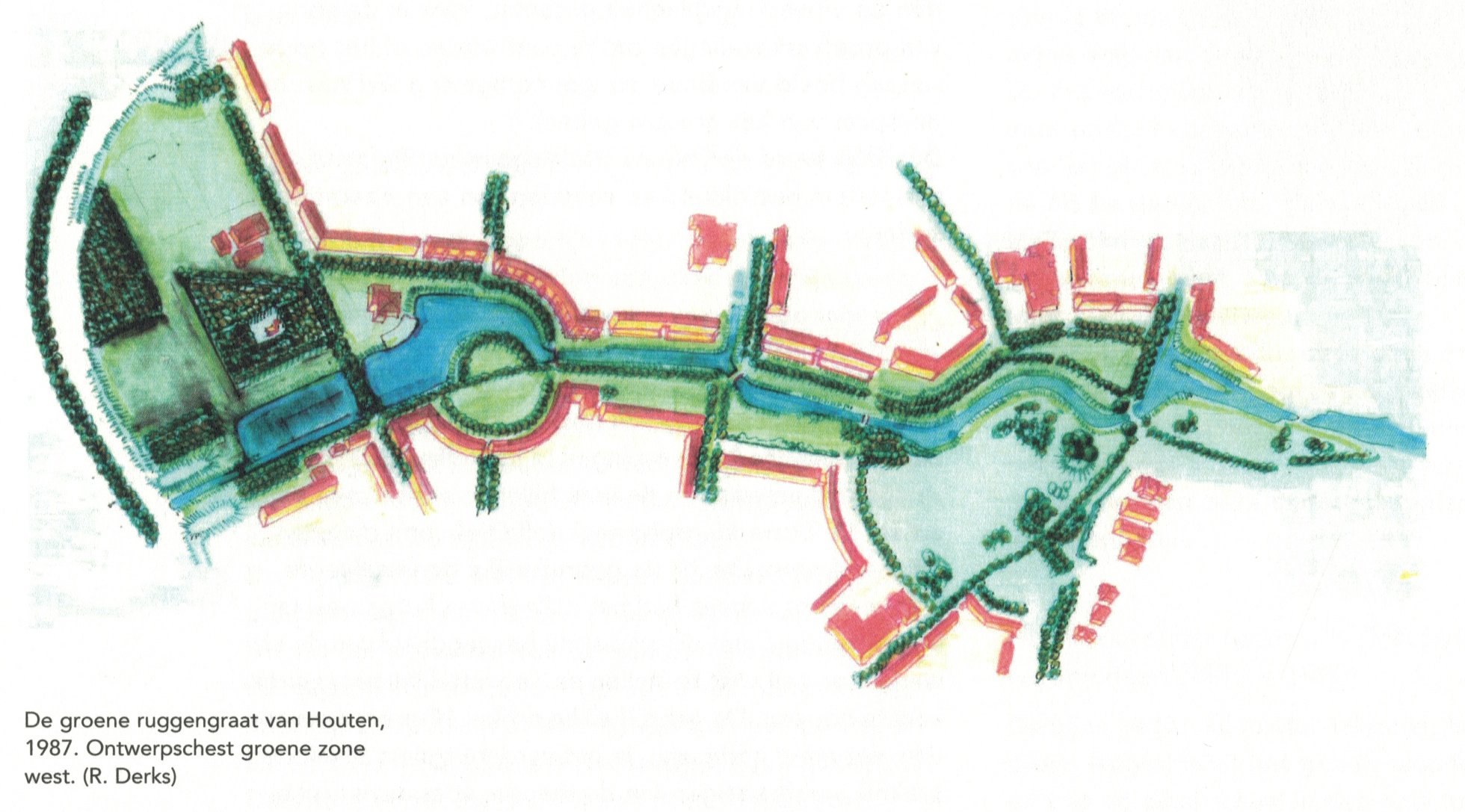
"The green backbone of Houten, 1987. Design sketch green zone west. (R. Derks)"
This 1987 design sketch illustrates the western extension of Houten's pioneering "Centrale Groenzone" - a continuous 3.5-kilometre green corridor that forms the structural backbone of this Dutch new town.
Source: "Het groen omarmd: Ontwerpen aan Houten" by Robert Derks (Uitgeverij Blauwdruk, 2013)
The Inversion Theory: "Het Groen Omarmd" (The Green Embraced)
Houten's revolutionary approach, known as "inversiestedenbouw" (inversion urbanism), fundamentally reversed traditional planning priorities. Instead of starting with roads and adding green space as an afterthought, Houten began with green infrastructure as the foundation:
- Green First: The central green spine and network of parks were designed first as the structural backbone
- Buildings Second: Residential and commercial buildings were then arranged to embrace and enhance these green spaces
- Cars Last: Vehicle access was accommodated only after the pedestrian, cycling, and green networks were established
- Continuous Green Network: Rather than isolated parks, Houten created an interconnected system of green corridors, waterways, and open spaces
![Houten's traffic hierarchy showing integration of different transportation modes [Source: Het groen omarmd]](img/houten-traffic-hierarchy.jpg)
"Traffic circulation scheme, from ring road to dwelling."
Source: "Het groen omarmd: Ontwerpen aan Houten" by Robert Derks (Uitgeverij Blauwdruk, 2013)
Integrated Traffic Hierarchy
The diagram above illustrates Houten's sophisticated approach to organizing different modes of transportation. The hierarchy progresses from the ring road (hoofdstructuur/main structure) through neighborhood access roads (buurtontsluitingsweg) to residential streets (woonstraat), with each level designed for specific functions:
- Main Structure (Hoofdstructuur): The ring road contains all through traffic and high-speed movement
- Neighborhood Access (Buurtontsluitingsweg): Medium-capacity roads that distribute traffic to residential areas
- Residential Streets (Woonstraat): Low-speed, low-volume streets prioritizing livability
- Integrated Networks: Cycling routes, pedestrian paths, and green corridors operate independently but connect seamlessly
- Density Relationship: Higher densities are placed near transit nodes and cycling infrastructure, creating walkable neighborhoods without car dependency
Long-Term Continuity Approach
Houten's success stemmed from maintaining design integrity across decades of implementation. The same core professional team worked together for over 30 years, ensuring that the original vision was preserved while allowing for thoughtful evolution. This continuity, combined with strong municipal oversight and political commitment, prevented the typical compromises that often undermine planned communities during their development phases.
Key Insight
Houten demonstrates that process continuity and integration may be more important than process type. The success came from maintaining design integrity and collaborative expertise across decades of implementation, while always prioritizing the green infrastructure foundation.
Interactive Map of Houten's Street Network
Explore Houten's unique street network design. Toggle different road types to understand how the city separates different modes of transportation and creates its distinctive ring road system.
Road Types
Map Features:
- Major Roads: The ring road system and other primary routes that contain vehicular traffic
- Cycle Paths: Dedicated cycling infrastructure, largely separated from motor traffic
- Residential Streets: Local streets within neighborhoods with minimal through traffic
- Railway Lines: The two train stations and rail connections to Utrecht
Click on any road to see more information about it. Data sourced from OpenStreetMap (Last Updated July 2025).
Life in Houten: A Resident's Perspective
In this interview by Active Towns, Kylie van Dam, a resident of Houten, shares her experience of living in this unique community. Originally from Australia, Kylie moved to Houten with her family after living in England, drawn by the cycling culture and people-oriented environment.
Key insights from Kylie's experience:
- The profound psychological benefits of living in a low-stress traffic environment
- The independence children enjoy from a young age
- How the urban design fosters social connections and community building
- The accessibility for people of all ages and abilities
- Houten is not a car-free community - most families own cars but use them selectively
Kylie emphasizes that what makes Houten special isn't just the infrastructure, but the underlying values it represents: prioritizing human connections, health, safety, and quality of life.
Books: The Green Embraced / Model City Houten
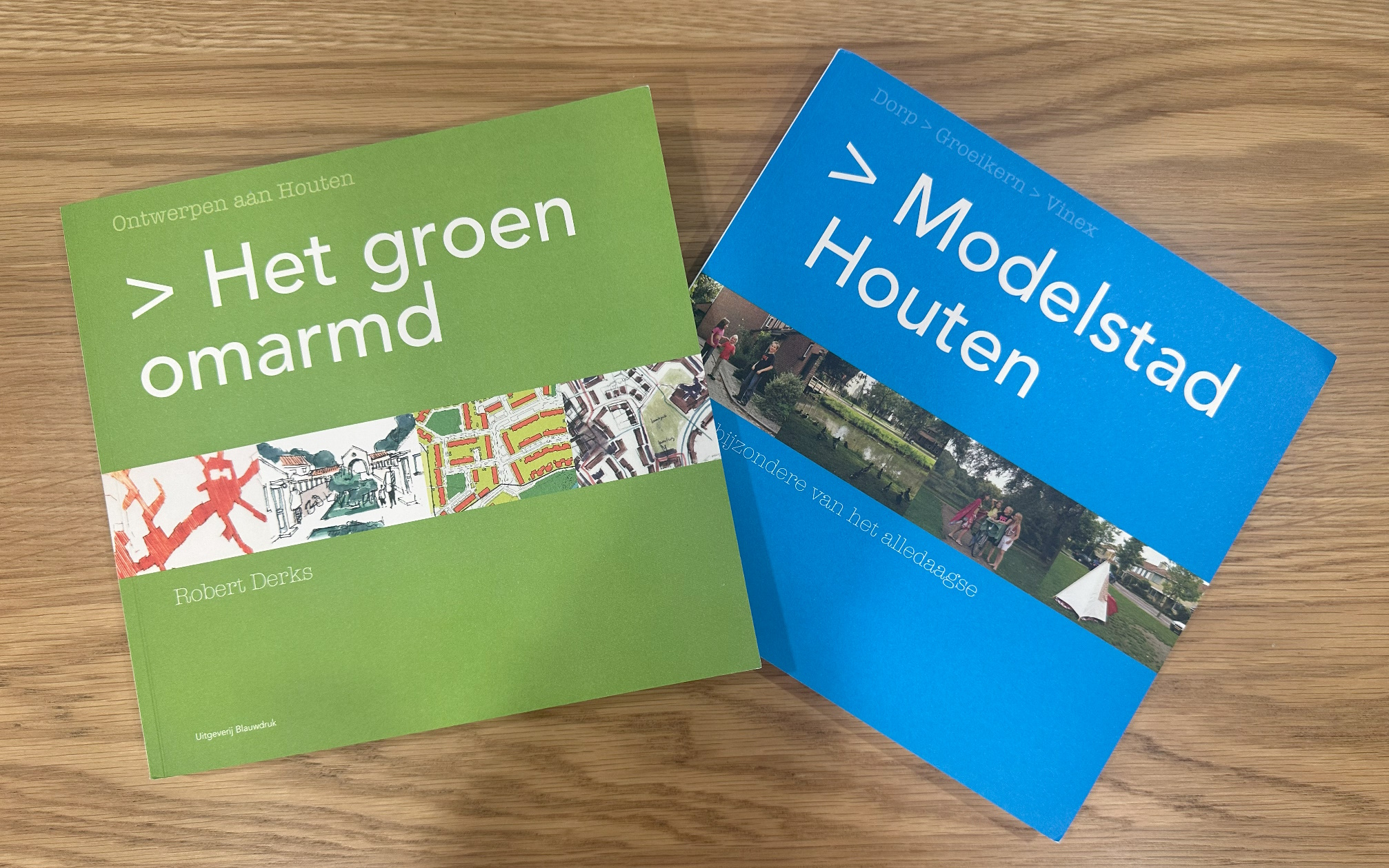
For those seeking a comprehensive understanding of Houten's development, these two Dutch books provide the most detailed account of the city's history, planning principles, design process, and implementation.
Het groen omarmd (The Green Embraced)
Written by urban planner Robert Derks, who was involved in Houten's development from the beginning, this book reveals the ideology, theories, and collaborative process that created Houten. Derks explains how planners, urban designers, traffic engineers, landscape architects, and architects worked together, their experiments, inspiration sources, and how visions evolved over the years. The constant throughout was attention to green space.
Modelstad Houten (Model City Houten)
This companion volume focuses on the human experience of Houten's transformation from a village of 3,000 to a city of 50,000 inhabitants. Through essays and portraits of actual residents, it paints a picture of growth and daily life in this thoughtfully designed community with its ingenious traffic system, abundant green space, and carefully designed public realm.
Purchase Options:
Books are currently available in Dutch only.
English Translation Project: "The Green Embraced"
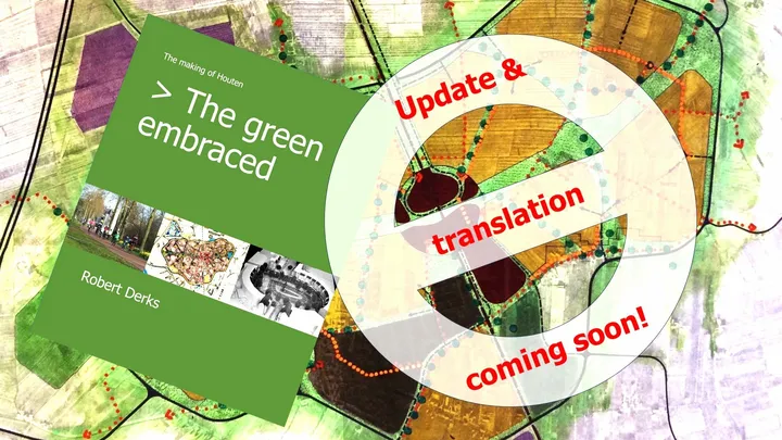
Recognizing the global need for sustainable urban design examples, Kylie van Dam (the Houten resident featured in the Active Towns interview above) is leading a crowdfunding project to translate Robert Derks' comprehensive book "Het groen omarmd" (The Green Embraced) into English.
Help bring Houten's story to the world through this community-driven translation project.
Outcomes & Results
Transportation Patterns
- 44% of all trips within Houten are made by bicycle
- 21% of trips are made on foot
- Only 35% of internal trips are made by car
- For trips to/from Houten, cycling still accounts for 25%
- Extremely low traffic accident rates
Quality of Life
- Quieter, cleaner environment with less pollution
- Children enjoy freedom of movement from a young age
- Strong sense of community with more face-to-face interaction
- Excellent public health outcomes
- Accessible for elderly and disabled residents
Economic Benefits
- Lower infrastructure maintenance costs
- Reduced healthcare costs due to active transportation
- Less money spent on car ownership per household
- Vibrant local businesses in walkable centres
- Diverse housing options at various price points
Recognition
- Named "Cycling City of the Netherlands" in 2008 and 2018
- Subject of numerous urban planning studies worldwide
- Regularly hosts international delegations studying its design
- Featured in urban planning textbooks and journals
Learn More
References and Further Reading
Special Thanks
- Nic Laporte: YouTube Channel / Bluesky / Instagram.
Special thanks to Nic Laporte for creating our first featured video! - Not Just Bikes: YouTube Channel.
Special thanks to Not Just Bikes for featuring Houten and promoting the translation project!
Lessons for Langley
While Houten was built as a new development, many of its principles can be adapted for existing communities like Langley:
- Rethinking Arterial Roads: Langley's pattern of wide arterial roads cutting through neighbourhoods and the city centre contrasts sharply with Houten's ring road approach. Redirecting through-traffic to peripheral routes while calming interior streets could dramatically improve livability.
- Grade Separation: Houten's extensive use of underpasses at busy intersections eliminates dangerous interactions between cyclists and high-speed vehicles—a model Langley could adopt to make cycling safer across major roadways.
- Incremental Implementation: Techniques like modal filters can gradually shift neighbourhoods to be more pedestrian and cycling friendly
- Backbone Networks: Creating safe, continuous cycling and walking routes that connect key destinations
- Neighbourhood Planning: New developments can adopt similar principles, even at a smaller scale
- Strategic Road Hierarchies: Rethinking how we organize traffic to prioritize living spaces
- The Value of Trust: Houten demonstrates that when given safe infrastructure, people will choose active transportation
The success of Houten challenges the notion that car-dependent development is inevitable in modern communities. It provides a working model of how intentional planning can create places that are more sustainable, more financially resilient, and more human-centered.
About Our Case Studies
These case studies were researched and compiled by Strong Towns Langley Chair, James Hansen, to identify successful implementations of people-first urban design principles that could inform development in our region.
Have a suggestion for a case study we should explore? Know of an interesting example of sustainable, financially resilient urban development?
Contact James directly at james@strongtownslangley.org, find him on our discord, or contact us with your ideas.

James Hansen
Strong Towns Langley Chair
